Geology and the power of water
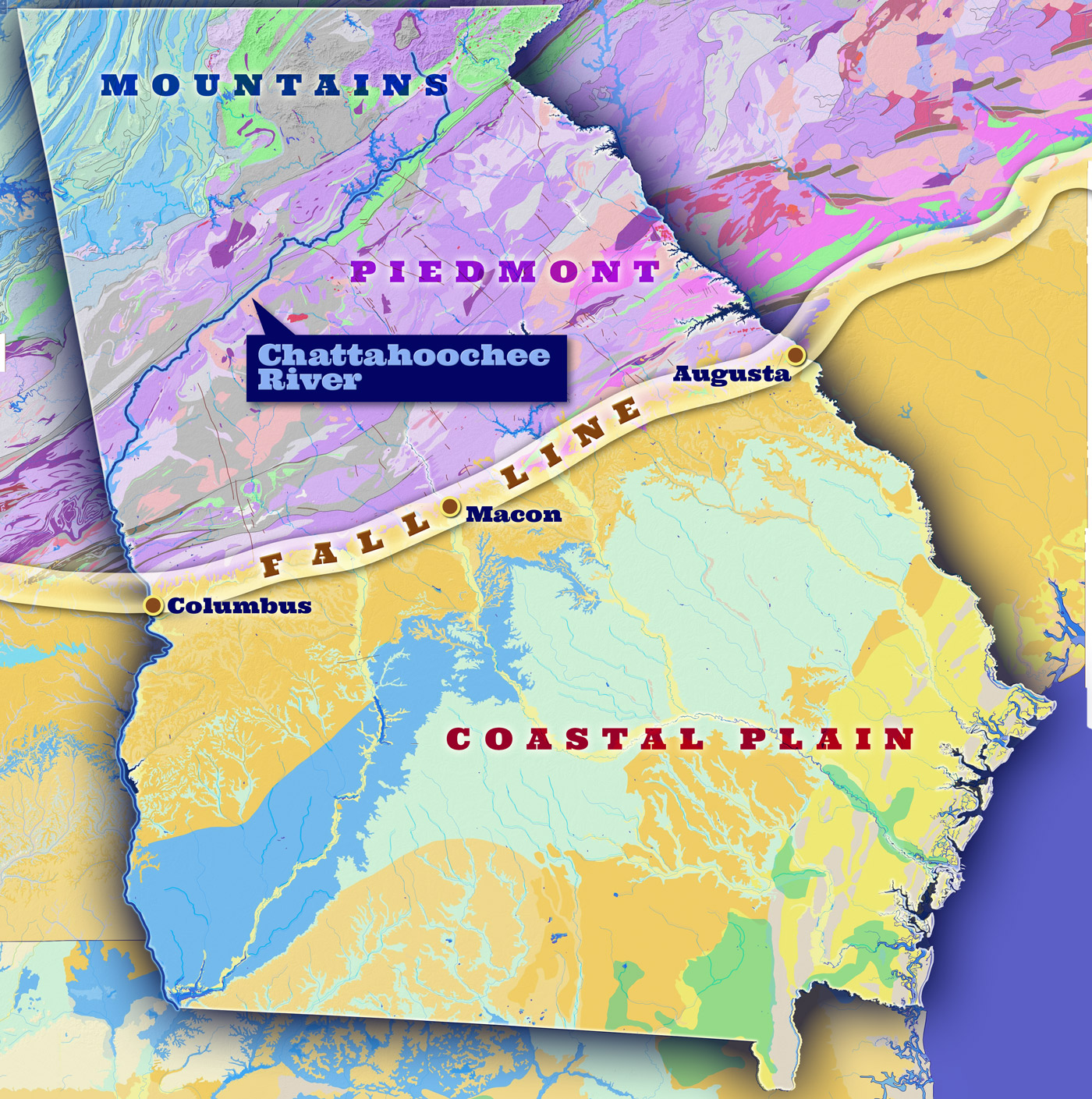
The Fall Line
The Fall Line, a Mesozoic shoreline of the Atlantic Ocean, runs in a northeast direction from Columbus to Augusta, Georgia and serves as the boundary between the Piedmont and Coastal Plain. Soils north of the Fall Line, in the Piedmont, tend to have a clay consistency while soils in the Coastal Plain, to the south of the line, are more sandy. The term Fall Line is used because the first waterfalls, or rapids, in rivers and streams occur along this line, which is approximately 20 miles wide. The waterfalls are encountered as one comes inland from the ocean and result from the decrease in elevation and exposed rock.
In Georgia, the cities of Columbus, Macon, Milledgeville, and Augusta developed along the Chattahoochee, Ocmulgee, Oconee, and Savannah Rivers. Entrepreneurs settling in these cities quickly noticed the water power potential offered to their industries created by the Falls.